GEO-K is partner of ɸ-Sat-2! The ESA Artificial Intelligence Earth Observation Mission

Following yesterday’s successful launch of ɸ-sat-1 (Europe’s first artificial intelligence Earth observation mission) plans are already underway for the next innovative state-of-the-art technology, ɸ-sat-2. It will demonstrate the capabilities of artificial intelligence (AI) technology for Earth observation. The use of these technologies will lead to new ways of collecting, distributing and analysing data about our planet.

GEO-K, as part of a consortium from six different European countries leded by Open Cosmos, developed an innovative solution for ɸ-sat-2 that has been selected as the winning idea by a panel of ESA experts. Find details on our contribution in projects section

Our  ɸ-sat-2 proposal involves an Earth observation 6U CubeSat platform capable of running AI apps that can be developed, easily installed, validated and operated on the spacecraft during their flight using a simple user interface.

Besides GEO-K, the consortium includes CGI, Ubotica, Simera CH Innovative, CEiiA and KP Labs.

Find more on ESA website.

DronEM (Drone for Electromagnetic fields Measurements)

The collaboration between GEO-K and MPB Group allowed the design and implementation of a novel technique for 3D measurement and mapping of Electro-Magnetic field distribution.

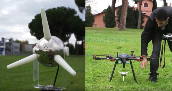
DronEM permits the estimation of EM pollution and the creation of pollution maps, as well as the verification of signal quality and cover. The system consists of a Drone equipped with a Selective Electric Triaxial Probe (SEP) and is able to scan the electromagnetic spectrum between 10 MHz and 3 GHz, till 200 m altitudes.

This UAV+SEP technique allows a precise monitoring activity and the possibility to plan automatic missions at different flight heights with high accuracy.

Check the design activities here
Check the validation activities here

Visibility trials for drone detection

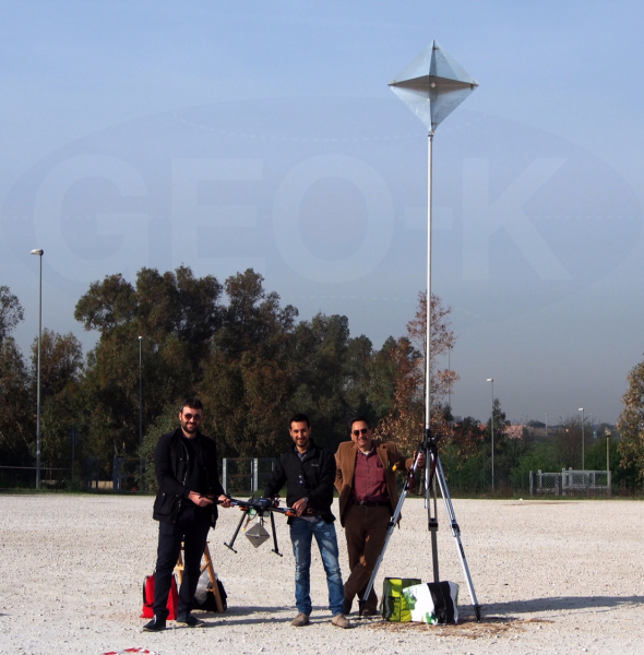
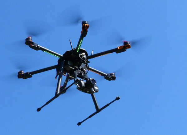
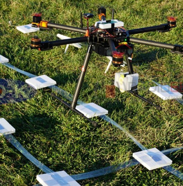
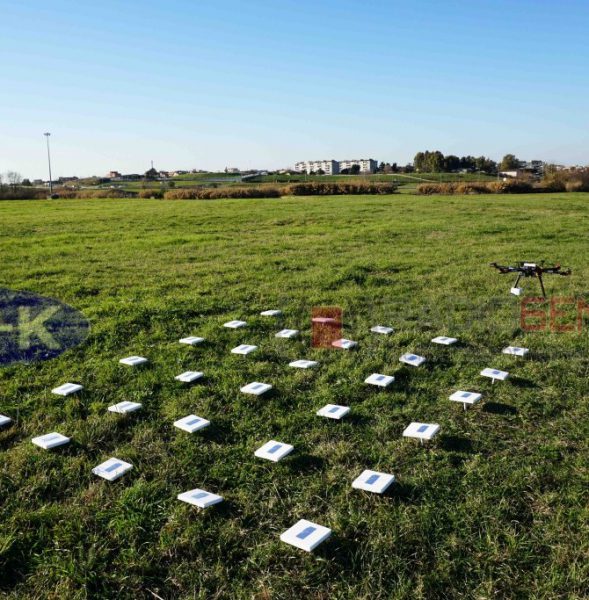
GEO-K, collaborating with the RADARLab of the Electronic Department of the “Tor Vergata” University, is performing drone’s visibility trials making use of its exa-rotor high-quality carbon fiber frame drone, an X-band radar and a corner reflector with known RCS. These tests are going to show the detection capability of Radar Systems, retrieving also the radiometric characterization of commercial drones.

The term “drone” is commonly used to indicate an unmanned aerial vehicle (UAV), or an aircraft which is remotely controlled by a ground-based operator. During the last years, drones have increasingly captured the interest of entrepreneurs and investors alike as a means to take over certain tasks, such as commercial, scientific, recreational and agricultural applications, surveillance services, product deliveries and aerial photography. Recently, the growing use of drones also among common people is due to the possibility of purchasing them at a lower price, increasing concerns about their use. Last year, in fact, more than 3456 incidents involving drones were recorded, compared with only 1237 in 2015, PA news agency reported. Moreover, drones have been reported to be used for criminal purposes and illegal actions. The problem of how drones can be detected and controlled over a limited area is directly rising up. Radar sensors are suitable to detect big objects, but drones may also be seen.


GEO-K meets the IEEE President, Barry L. Shoop

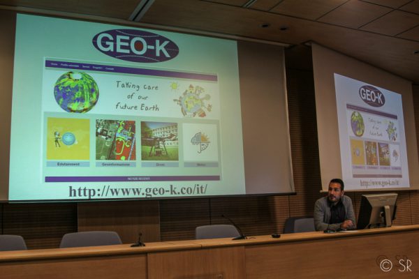
An interesting appointment together with other interesting enterprises: that’s what had occurred at GEO-K, September, 27th, participating in a workshop with Barry L. Shoop, IEEE president, at the Faculty of Engineer at the University of Rome Tor Vergata.

The IEEE vision: “To be essential to the global technical community and to technical professionals everywhere, and to be universally recognized for the contributions of technology and of technical professionals in improving global conditions”. For this, in addition to a good turnout of students and researchers, Shoop had accepted to meet the innovation groups and people of the Faculty: GEO-K, the first spin-off of Tor Vergata, is between them.

Speaker: Daniele Latini, Ph.D. and pilot of GEO-K’s drones.

(photo by Simona Ranieri)

GEO-K is recognized by ENAC for critic scenario operations

Monitoring flying operations with GEO-K drones. Not only uninhabited areas but also critic ones (e.g. urban areas, streets, etc).
GEO-K drones can fly over buildings to monitor architectural and artistic heritage, but also to measure electromagnetic fields and building structures.

The ENAC authorization (Rif.ENAC: 5315) has permitted to complete all the procedures to operate in different scenarios, thanks to GEO-K’s authorized pilots.

Contacts:
apr@geo-k.co
Ph. +39 06 7259 7734-7711
———————————–
GEO-K Srl, APR Division
Via del Politecnico, 1 00133 – Roma – Italy

FabSpace 2.0 in Universities 2.0

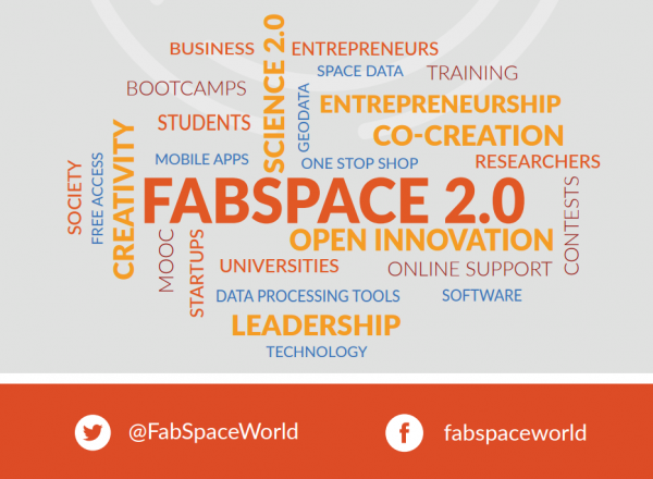
FabSpace 2.0 is the open-innovation network for geodata-driven innovation by leveraging Space data in Universities 2.0. Its Work programme topic addressed INSO-4-2015: Innovative schemes for open innovation and science 2.0 (b) Academia- Business/Public/CSO knowledge co-creation Coordination and support action.

The FabSpace 2.0 project aims at making universities open innovation centres for their region and improving their contribution to the socio-economic and environmental performance of societies. To achieve these general objectives, the FabSpace 2.0 project offers to concentrate on one research area with high expected socio-economic impact: data-driven innovation, with particular attention to Earth observation data.

In the six European regions covered by the consortium, partner universities work together with co-located Business Incubation Centres of the European Space Agency (ESA BICs). ESA BICs aim at inspiring entrepreneurs to turn space-connected business ideas into commercial companies and provide technical expertise and business-development support.

This project began on March 1st 2016 and will last 3 years. It is under the lead of Univ. Toulouse III – Paul Sabatier (UPS).

OBJECTIVES

The objectives of the FabSpace 2.0 project are to:

  • Set up and operate at University a free-access place & service where students, researchers and external users can make use of a data platform and design and test their own applications.
  • Train the users to improve their capacity to process data and develop new applications.
  • Network students, researchers, entrepreneurs, project managers in industry and public authorities, civil society organisations and other representatives of civilians, consolidate user needs and industry requirements, foster the co-creation of new innovative solutions, support further business development.
  • Exploit, sustain and disseminate the concept.
ACTIVITIES

The Work Plan will be implemented within 6 Work Packages:

  • WP1 – Setting up and operating regional FabSpace services
  • WP2 – Enhancing human capital among the targeted groups of users
  • WP3 – Animation and Networking for innovation and entrepreneurial discovery
  • WP4 – Exploitation and dissemination
  • WP5 – Communication
  • WP6 – Management
RESULTS

The major impacts of the project can be summarised as follows:

  • Make universities & research organisations more involved in innovation activities, through the development of interactions with innovators in industry and the public sector, with an increasing socio-economic impact
  • Boost innovation skills in public administration
  • Equip researchers with innovation leadership knowledge
  • Raise awareness of the potential of co-creation of new solutions and other open innovation activities.
Click here for more information about the ESA BICs.

EUMETSAT & CNR with GEO-K united by an Algorithm

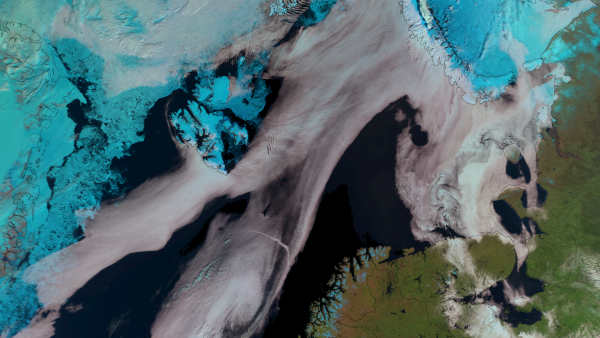
On 20 of May 2016, at the EUMETSAT Headquarters in Darmstadt, Germany, GEO-K signed a new contract for a study about cloud detection over sea ice using the “Sea and Land Surface Temperature Radiometer” (SLSTR) instrument aboard on Sentinel 3 satellite.

Sea ice is typically present on polar oceans of the planet and has a crucial role on climate. Therefore, monitoring its morphological structure, its changes and its temperature is important to have a clear picture of the actual and future climate state.

To do these kind of observations at best, it is important that the satellite view is completely free of clouds, then it becomes necessary an algorithm that can distinguish a white brilliant cloud from an ice surface also white and shiny. GEO-K, in collaboration with ISAC-CNR (Italian Institute of Atmospheric Science and Climate) as subcontractor, will supply such an algorithm.

The people involved in this project are: Massimiliano Sist (GEO-K), Lia Santoleri (ISAC-CNR) and Gianluigi Liberti (ISAC-CNR).


Thales Alenia Space Italia chooses GEO-K technology for SAR data analysis

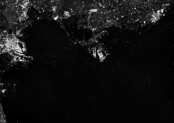
Thales Alenia Space Italia chooses GEO-K to realize new platforms for COSMO-SkyMed SAR data analysis.

The agreement signed on 22 March 2016 requires the creation of a first suite for automatic analysis application for oil spills, ship survey, coastline extraction and land cover classification. All of this will be detected by neural network technology developed by GEO-K over the past years.

Both GEO-K and TAS-I wish the just-signed agreement may be renewed in view of new potential available with COSMO Second Generation Data.


RFIDrone: when a drone reads radiofrequency

The partnership between GEO-K and RADIO6ENSE aims to build up a system that exploits the paradigm of radiofrequency identification (RFID) and the potentialities of Unmanned Aerial Vehicles (UAV).

The RFIDrone project will be developed considering two main approaches: the first, named DroneReader, consists of a UAV hexacopter able to carry out autonomous missions in which the data transmitted by RFID are collected and used for creating thematic maps or for characterizing the object under analysis.  The second, named DroneTAG, consists of a UAV acting as a RFID, becoming itself a TAG with autonomous re-locating capabilities. In both cases, the system offers revolutionary potentials in the monitoring of structures pre- or post-event (bridges, buildings, dams), precision farming applications, surveillance, and logistics.


EO Lab in Tor Vergata and ESA Bic Lazio will create the Italian FabSpace

The Fab Space 2.0 project (led by the French university Toulouse III Paul Sabatier) was approved under the Horizon 2020 program: 3,5 million euros to create innovative and space-oriented fab labs in 6 European countries.

Universities are the protagonists and in particular those of France, Italy, Belgium, Germany, Poland, Greece. They will become (even more) centers for innovation. According to the project partners, Fab Space 2.0 will concentrate in a single territorial area of ​​research and innovation also the decisive contributions for a strong socio-economic and environmental effect: innovation guided by geo-information data, mainly derived from Earth observation space missions.

Universities must adopt the new role of innovation co-creators in the context of Science 2.0. They must realize the future scenario in which open data come into play in a creative environment: there, the developers who come from civil society, industry and academic research, public and territorial administrators can meet, work together and co-create new tools and new business applications.
So here is the new type of fab lab: the FabSpaces. They will be a key point in which to find large varieties of data (including ‘spatial’ data) and free tools for data processing and software, all for designing new applications. A real innovation realized thanks to the knowledge of data. The link between universities, industries, public administration and civil society will be reinforced by local and European initiatives for application development. Around 1,500 European students and researchers are expected to use FabSpaces.


In Italy, the protagonists are the ESA BIC Lazio incubator and the EO LAB – the Tor Vergata Earth Observation Laboratory.
The laboratory of the University of Rome Tor Vergata, with the coordination of Professor Fabio Del Frate of DICII – Department of Civil Engineering and Computer Engineering, will be responsible for the creation of real and virtual laboratories that will use the latest web technologies for both training and technology transfer in the fields of geoinformation and Earth Observation, all in close connection with the progress of scientific research.

The financing of the project (356 thousand € will go to Tor Vergata / EO Lab) – says Fabio Del Frate – is a source of great satisfaction because it enhances the activities of our University and our Department especially in the field of Earth Observation“. “At the same time – continues Del Frate – the utmost effort will be needed to achieve, in collaboration with the other organizations, the objectives presented in the proposal. In particular, as a university, the ability to significantly strengthen the role of meeting point between training, research and technology transfer in the aerospace and geo-information sectors, focusing on the new generations of students and the requests coming from society civil“.


Some useful links:

Fabspace 2.0 website
Tor Vergata Computer Science, Control and GeoInformation Doctorate