GEO-K supports ESA for Sentinel-2 data calibration using drones

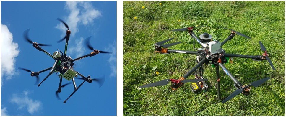
Our UAV equipped with MAIA multispectral sensor and ILS (Incident Light Sensor) flew on 26-11-2020 at 10:03 UTC over selected test site, overlapping exactly the passage of Sentinel-2 satellite. The UAV altitude was of 90 m with a GSD of about 5 cm and a FOV of 60 m × 45 m.

The flight has been carried out in the contex of QA4EO ESA project which aims to tackle the challenges associated to surface reflectance and BRDF validation using advanced UAV-based techniques.

New flights and data elaboration are scheduled in the next months.

drone brdf sensors

EUMETSAT & CNR with GEO-K united by an Algorithm

On 20 of May 2016, at the EUMETSAT Headquarters in Darmstadt, Germany, GEO-K signed a new contract for a study about cloud detection over sea ice using the “Sea and Land Surface Temperature Radiometer” (SLSTR) instrument aboard on Sentinel 3 satellite.

Sea ice is typically present on polar oceans of the planet and has a crucial role on climate. Therefore, monitoring its morphological structure, its changes and its temperature is important to have a clear picture of the actual and future climate state.

To do these kind of observations at best, it is important that the satellite view is completely free of clouds, then it becomes necessary an algorithm that can distinguish a white brilliant cloud from an ice surface also white and shiny. GEO-K, in collaboration with ISAC-CNR (Italian Institute of Atmospheric Science and Climate) as subcontractor, will supply such an algorithm.

The people involved in this project are: Massimiliano Sist (GEO-K), Lia Santoleri (ISAC-CNR) and Gianluigi Liberti (ISAC-CNR).


URBANFLUXES at Rome 2015 Science Symposium on Climate

GEO-K took part at the Rome 2015 Science Symposium on Climate poster session, on November 19-20, with a contribution to URBANFLUXES project.

The recently launched Horizon 2020 project URBANFLUXES investigates the potential of EO to retrieve urban energy budget components, focusing on the anthropogenic heat flux. The main challenge of this project is the innovative exploitation of the Copernicus Sentinels synergistic observations to estimate local scale spatio-temporal patterns of the anthropogenic heat emission in cities. These EO-based spatially disaggregated estimations contain valuable information for both the urban planning and the Earth System Science community.


Urban Imagery for thermal behavior of cities at JURSE 2015

Earth Observation (EO) systems and the advances in remote sensing technology increase the opportunities for monitoring the thermal behavior of cities.
Several parameters related to the urban climate can be quantified from EO data products, providing valuable support for advanced urban studies and urban climate modeling.
The study has been presented at the last JURSE congress in Lausanne. In this study, remote sensing techniques are applied to derive quantitative information necessary to identify possible zones with homogeneous thermal characteristics (Local Climate Zones LCZ).

Parameters like the pervious and impervious surface fraction, the surface albedo, the building density, the mean building/tree height, and the sky view factor are quantified for a study area in Crete, Greece. The EO products are then used under a methodological framework to map the LCZ.

Individual EO products, as well as the LCZ classification itself, is useful to urban climate modeling and studies to assist in planning and decision making.

Future research includes the investigation of more urban parameters extraction with EO data, with the ultimate goal of developing a methodology adaptable to the Sentinels.