GEO-K
  • Home
  • Activities
  • Projects
  • About us
  • Blog
  • WebGIS Platform
  • Twitter
  • Linkedin
  • Facebook

PRECISION FARMING

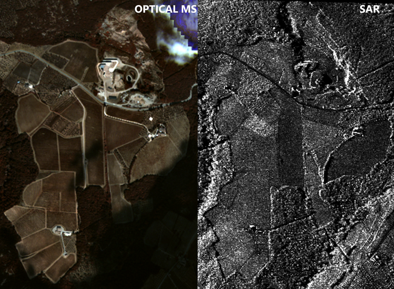
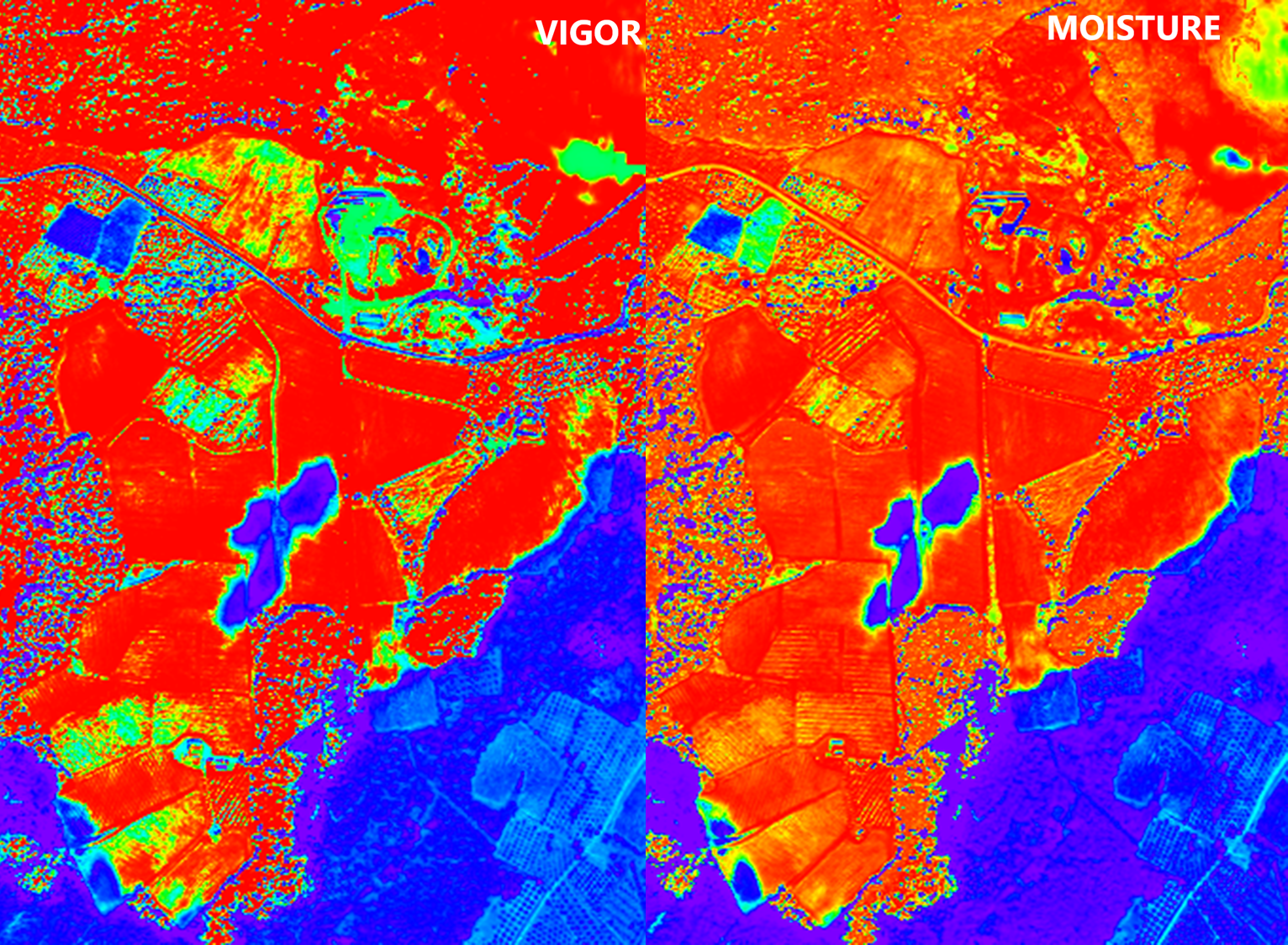
The term “Precision Farming” embraces a set of tools and technologies to analyse in-field soil and crop variability for improving farming practices and optimizing agronomic inputs. Remote sensing (Satellite, aircraft and UAV drones) is the most cost effective method for large scale monitoring, making use of Synthetic Aperture Radar and multi- or iper- spectral optical sensors considering visible, near infrared (NIR), short wave infrared (SWIR) and thermal bands.

GEO-K provides spatialized information to agronomist for monitoring of crop stresses, crop diseases, soil water stress, and planning for irrigation scheduling and harvesting operations. The algorithms can integrates punctual samples from on-field network of sensors, fusing also data from meteorological stations.

Return to Activities
© Copyright - GEO-K - Only technical cookies are used for this site
Scorrere verso l’alto