GEO-K
  • Home
  • Activities
  • Projects
  • About us
  • Blog
  • WebGIS Platform
  • Twitter
  • Linkedin
  • Facebook

Login Earth: who knows the right answer?

15 Marzo 2016/in Earth Observation, Education /da admincl

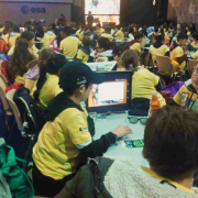
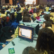
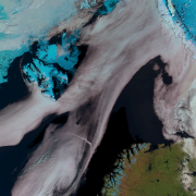
Login Earth is GEO-K’s app for Android ambient to test the player’s ability to recognize cities, regions, rivers and deserts of our planet, using satellite products also in different wavelengths! In fact, the best players that will be able to complete level 4, will unlock the fifth level of the game and play with images taken by satellites’ radars.

Download it at Google Play


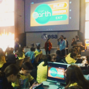
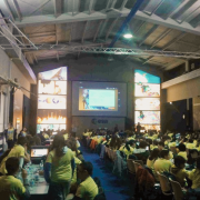
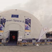
On March 10 and 11, hundreds scholars, 11 to 13- aged and coming from the Rome area, had the opportunity to have fun with Login Earth at the ESA-ESRIN Open Days, organized by the Italian centre of the European Space Agency ESA, on 7-11 of March 2016. Boys and girls were engaged to give the right answer to discover which part of the Earth had been shot by satellites.

Would you be able too?

Download it at Google Play


Tags: android, app, Earth Observation, education, edutainment, EO, ESA, European Space Agency, GEO-K, innovation, Login Earth, satellite
Condividi questo articolo
  • Condividi su Facebook
  • Condividi su Twitter
  • Condividi su Linkedin
  • Condividi su Reddit
  • Condividi attraverso Mail
https://www.geo-k.co/wp-content/uploads/2016/03/10.png 1728 2304 admincl https://www.geo-k.co/wp-content/uploads/2019/11/NEW_GEO-K_logo_trasp1.png admincl2016-03-15 11:23:462020-02-05 14:11:14Login Earth: who knows the right answer?
Potrebbero interessarti
Onboard Processing: GREAT, a precursor to the first Italian space mission for GNSS Reflectometry
Login Earth, the app to play Geography from Space at the ESA Open Science 2.0
GEO-K invited at the European Space Expo
GEO-K won the Best Ideas challenge at the GMES Masters Competition 2012
EUMETSAT & CNR with GEO-K united by an Algorithm
RFIDrone: when a drone reads radiofrequency
© Copyright - GEO-K - Only technical cookies are used for this site
RFIDrone: when a drone reads radiofrequency Thales Alenia Space Italia chooses GEO-K technology for SAR data analysis
Scorrere verso l’alto